Thursday, December 25, 2014

Ability to Export Maps to Image

I added the ability to export maps to a custom-sized image (PNG file) for Map Enthusiast and higher. On the interactive map menu, set the background, features, and zoom you would like in the image. Then select "Menu" and then "Export Map." A window will pop up with some instructions. Select your dimensions and press "Export to Image." Wait for the map to be exported, and then... Presto! You have an image of the map (with a small Paddle Planner logo in the corner).

Export to Image Example

The larger the image, the longer the process will take. Most of the process runs on your computer, so if it is a large image, it will also take up a lot of computer resources. In my tests, though, "normal-sized" images (page size or less) don't take too long to process.

Tuesday, October 14, 2014

Finished Atikaki and Whiteshell Route Finder

I finished the Route Finder for all of the parks on the Manitoba-Ontario border, which includes Atikaki, Nopiming, Manigotagan River, Whiteshell, and Woodland Caribou. Go to the interactive map to try it out!


There are some "problem areas"
  • As you can see, I was only able to complete the Route Finder for the southern portion of Atikaki Provincial Park. I don't have any portage or campsite information yet for the northern or western areas of the park.
  • I didn't have any portage information for the Eagle-Snowshoe Conservation Reserve (the area between Nopiming and Woodland Caribou). To make the Route Finder work between Snowshoe Lake and Eagle Lake, I just "assumed" there were no portages on the river. This is obviously not true since there are rapids and falls on the river, so keep this in mind if using the Route Finder in this area.
  • The map that I had of Whiteshell Provincial Park just noted that there were many portages, rapids, and falls on the Whiteshell River. I don't know where most of those portages are, so I did not complete the Route Finder on this river.
Portage and campsite locations are approximate. If you have any GPS tracks of portages or exact campsite locations, please contact me so I can make the maps more accurate.

The Route Finder is a unique tool that you can get estimated paddling times and distances between any two or more points. The distances and times are broken down between paddling and portaging, and the map shows the shortest route between the points. Right now it works for the Boundary Waters in Minnesota, Sylvania Wilderness in Michigan, Quetico and Woodland Caribou in Ontario, and Atikaki, Nopiming, Manigotagan River, and Whiteshell in Manitoba.

Wednesday, October 1, 2014

Woodland Caribou PP Route Finder Finished!

I finished the Route Finder (paddling time/distance calculator) for Woodland Caribou Provincial Park! I worked hard the last few nights to finish up the northern half of the park. You can use the new Route Finder on the Manitoba-Ontario Wilderness paddling map.

Completed Canoe Routes in Woodland Caribou and Nopiming
If you are new, I should explain what the Route Finder is. The Route Finder is a unique tool that you can get estimated paddling times and distances between any two or more points. The distances and times are broken down between paddling and portaging, and the map shows the shortest route between the points. Right now it works for the Boundary Waters in Minnesota, Sylvania Wilderness in Michigan, Quetico and Woodland Caribou in Ontario, and Nopiming and Manigotagan in Manitoba. More areas will be added soon!

The Quetico Route Finder took me a year to create. Woodland Caribou is slightly larger than the Quetico, and it only took me about a month to finish. I must be getting better at this! Next up are Whiteshell and Atikaki.

Monday, September 29, 2014

WCPP, Nopiming, Manigotagan, and Atikaki Route Finder Progress

I completed the Route Finder for the backcountry canoe routes for Nopiming Provincial Park and Manigotagan River Provincial Park. You can now calculate time and distance estimates for the routes in these parks.

I have also continued working on the northern Woodland Caribou Provincial Park routes. You can see my progress in the image below. Along with this, I have connected Wallace Lake in Atikaki Provincial Park to the Obukowin Lake and Wanipigow River entry points in Woodland Caribou. Wallace Lake is the usual starting point for these two entry points.

It shouldn't be too much longer until I have Woodland Caribou completely finished and I start working on Atikaki and Whiteshell.


Saturday, September 27, 2014

Paddle Planner.com Video

Tired of the map and string method of measuring paddling distances? Try PaddlePlanner.com!


This is our first try at a video promoting the website. I think it turned out pretty well considering our very limited resources.

Tuesday, September 23, 2014

Woodland Caribou Route Finder Progress

I'm making good progress on the Route Finder for Woodland Caribou. The entire southern portion is completed. Since this is the most traveled section of the park, the Route Finder should be usable for most people. The green in the image below is the portion that is completed and usable.

Sunday, September 21, 2014

New Maps and Tools

As we transition from paddling season to planning season, I thought I would give an update on the website and announce a few new maps and tools.

Added Manitoba-Ontario Interprovincial Wilderness Area
That's a long name, but it also is a big area. The wilderness area includes Woodland Caribou Provincial Park in Ontario and Atikaki and Nopiming Provincial Parks in Manitoba. Though not part of the wilderness area, I have also included the adjoining provincial parks - South Atikaki, Wallace Lake, Manigotagan River, and Whiteshell. These parks combined encompass over 3 million acres, about 3 times the size of the Boundary Waters, and include some of the most pristine paddling in the world. 

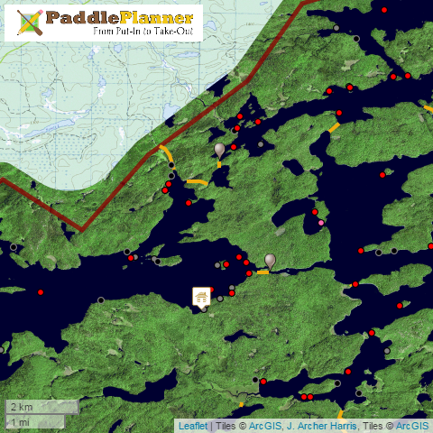
I am about halfway through adding the Route Finder to Woodland Caribou (I haven't started the other areas). The green area below is what I have completed so far (the yellow dots are portages). The Route Finder will work in the green area but will give an error if you try to route anywhere else. I periodically update my progress on the blog. 

You can access the new maps from the interactive maps page.

Maximum Distance/Time Tool Added to Route Finder
I'm not really sure what to call this, so I'll just have to explain it. The Route Finder was originally designed to give a time and distance estimate when you have a starting point and a destination. What if you don't have a destination, only a starting point? Where can you go in, for example, 4 hours? Most of my short weekend trips I start at an entry point and go for 3-5 hours. I don't have a set destination in mind. When trying to plan this in the past, I have had to do several calculations to figure out how far I can go. With the new tool, I can now specify a starting location and the time/distance I want to go, and the possible locations will be highlighted on the map. This tool will also come in handy when trying to plan day trips from a campsite.


The calculation takes more resources and more time than a regular Route Finder calculation, so I had to place limits on the tool's time and distance. Free accounts can plot up to 4 hours or 12 miles. Paid accounts can plot up to 8 hours or 24 miles. When using the tool, you need to be patient as the calculation can take a long time, especially if it is trying to plot over 4 hours. Though it should be rare, if the calculation takes over 5 minutes, it will give an error and stop.

Future Plans
My goal is to complete the following before planning season gets into full swing next January. I'm not sure if I'll be able to do all of it, but I'll certainly give it a try.
  • Add Algonquin Provincial Park - I have everything I need except for campsite locations. Getting permission to use any existing campsite data might be a little tricky, though.
  • Ability to export map images - I have almost finished making a tool to export a map to an image. You can always do it right now with screenshots, but this will make it easier.
  • Revamp Photo Upload Process - The photo upload and edit process currently can be a little confusing. I am going to revamp it and add some more tools, such as a way to bulk upload or edit photos.
  • Trip Planning Application - My vision is to have the ability to completely plan a trip on the website - permits, outfitters, gear and food lists, maps and routes, communications with other group members  - and keep all of the information in one spot with the ability to print a trip plan or store it as a PDF. It will be a big project, but I'm hopeful on getting it done before next planning season.
As always, I am open to suggestions and ideas. If there is something you would like to see on the website, just send me an email.

Wednesday, September 3, 2014

Woodland Caribou Route Finder Progress

I have started working on the Route Finder for Woodland Caribou Provincial Park. Since it is as big as the Quetico, it will probably take quite a while to finish. In the image below, the green is what I have completed so far. The Route Finder will work for that area but will give an error if you try to route anywhere else.


Tuesday, August 19, 2014

Woodland Caribou Provincial Park

I added an interactive map for Woodland Caribou Provincial Park. It is still a work in progress. I still need to add the entry points. The RouteFinder may take a while to finish since it is such a big area. I need to clean up/add some of the lake data. I am also looking for a more comprehensive source for the campsites (there are supposedly over 2,200 campsites, but I only have data for about 800). Despite this, I thought it was good enough for now. It still has valuable information on it that will hopefully help the few intrepid paddlers who go to this park.

I have to give a big thanks to Joe_Schmeaux, who provided the campsite data and helped me a lot with finding everything else for the map. He also has helped me with the data for the adjacent Atikaki and Nopiming provincial parks in Manitoba. I'll get those parks added, too, as soon as I can.

Thursday, July 24, 2014

Name Changed to Paddle Planner

Finally! MN Canoeing has changed its name to Paddle Planner. Any links or embedded maps that currently point to mncanoeing.com will automatically be redirected to paddleplanner.com. The name was changed to reflect the expansion of the site beyond Minnesota. Along with the name change, I made many other improvements and additions. Listed below are just a few of them.

Added Sylvania Wilderness
Sylvania Wilderness in Michigan has been added to the interactive map and route finder and the databases. This is the first of many additions. I plan on adding Algonquin and Woodland Caribou provincial parks, the Apostle Islands, and the St. Croix and Namekagon rivers in the near future. If there are any other areas you would like to see, let me know and I will try to get them added.

With the new area, I have also slightly altered how you get to the interactive maps on the website. There are now maps for the BWCA, the Quetico, Sylvania, and the BWCA/Quetico combined.

New Background Maps
For those familiar with maps in the former Paddlers' Campsite Database (PCD) for the Quetico, I added a background with that map. It is a satellite view that Dr. J. Archer Harris put together from some aerial images of the Quetico. It is somewhat a "false color" image, but at least it is green and blue! Also, the best part - there are no clouds! This is a vast improvement over any other satellite images I've seen of the Quetico. I made this the default view for the Quetico-Only map.

I also added some background maps from the National Map. You can look at these by changing the background map in the upper right corner of the interactive maps.

Performance Improvements and Fixes
I made various performance improvements and fixed a few bugs throughout the site. Some of the biggest improvements were in the databases (campsites, portages, lakes, etc.). They should now load and sort much faster than previously.

To switch the website to accommodate multiple paddling areas, I had to make some big changes. With big changes inevitably come bugs. If you run into any problems on the site, please let me know.

Sunday, May 4, 2014

PCD has moved to MN Canoeing!

The Quetico Paddler's Campsite Database (PCD) has moved to MN Canoeing! For the last decade, the PCD has been the place to go for Quetico campsite information. It has over 1,200 campsite ratings for the Quetico. Dr. J. Archer Harris asked if I would like to take over the PCD and move everything over to MN Canoeing. Of course I accepted! This is a great opportunity, and I am honored to be chosen to carry on the work.

For those not familiar with the PCD and/or Quetico Park, the Quetico has no established campsites. You can camp anywhere that you can find a spot. That being said, there are only so many spots you can camp. The PCD was an effort to document and rate these campsites. Dr. Harris put a lot of time and effort into creating and maintaining the database. Many canoeists contributed their observations to the project, and the PCD became well-known among Quetico circles. A lot of the contributions were made by members of QuietJourney, so I have to thank all of them.

Wednesday, April 23, 2014

MN Canoeing 2.0

You may have noticed some big changes on MN Canoeing (I'm nicknaming it MN Canoeing 2.0). My wife and I have been working hard the past six months to almost completely redesign the website. The biggest change is that the website is now commercial instead of noncommercial. You will notice some ads on the site. There are also some paid features, which you can see on the membership level page.

Moving everything from my test website to the live website has been a little bumpy the past few hours. If you find anything that doesn't appear to be working correctly, please let me know.

Here is a summary of some of the changes:

New Features
  • Wiki - This has been in place for a few weeks, but it is still relatively new. 
  • Help menu - You can access the help menu from the interactive map. Right now it only contains instructions for the map. I will be adding more instructions and directions in the future, such as how to write a trip report and upload photos.
  • Outfitters - A list of outfitters is now included with the website. I tried to make it as comprehensive as possible. (If your business is missing and you think it should be included or you find mistakes, let me know.) Outfitter listings are also displayed in various places on the interactive map and in the entry point database.
  • Portage database - I finally got around to listing all of the portages as I had the campsites and lakes. The portage elevation graph was updated - it now looks better and has better data. Also, I made it possible to see a list of the portages you have commented on in your account. (This was a glaring omission before.)
  • Outfitter advertising at various spots on the site - see the advertising page.

    Updates
    • Redesigned home page - The picture displayed is picked randomly from a list of my favorite photos from members. My wife made the nice buttons to navigate around the site. 
    • Interactive Map - Because of the changes on the site and what I plan to do, I had to move away from Google Maps. I decided to go with a mapping library called Leaflet. The maps that the site now uses are different, but I think they actually look very good. I also made some performance improvements. Hopefully the map will now work better and use less memory.
      • Go to a campsite using its number
      • Outfitters in the entry point detail pages and the Route Finder
      • Overview map in the lower right hand corner (this can be collapsed)
      • When clicking anywhere on the map, elevation is now shown with the latitude/longitude and the maps
      • Different base maps than before - explore using the menu in the upper right
      • Scale in the lower left corner
      • Unreviewed campsites are now pink. This allows you to quickly see what campsites are reviewed and which are not. In the Quetico, a campsite is considered reviewed if there is an entry in the PCD or on MN Canoeing.
      • Most of the hiking trails had to be taken off because of the move to commercial status.
    • Clickable maps in the databases - On the individual entry point, campsite, portage, and lake pages, you can now click on points on the map to go to their respective pages. 
    • Performance improvements to the album and photo pages

    Future Plans
    • Complete trip planning application, including outfitter selection, checklists, food planning, route information, etc.
    • Photo contests
    • Quizzes and other competitions
    These are the main changes. There are a lot of little changes throughout the site that hopefully will make MN Canoeing a better tool for you. If you find something that isn't working or have a suggestion for a new feature, please let me know.

    Sunday, April 6, 2014

    New Logo

    You may have noticed a couple of changes in the logo the past few weeks. My wife is a great artist, and she wanted to learn how to use Inkscape (free version of Adobe Illustrator). For her first project, she wanted to redesign the MN Canoeing logo. Our first attempt was on the site for a couple of weeks.


    After some time, though, she thought that she could make a better one. She did a great job!